Stolpen von A - Z | Veranstaltungen | Sitemap | Kontakt | Impressum | Datenschutz | Barrierefreiheit


Some of the History of the Town of Stolpen and its Surrounding Districts
The Bishops of Meißen generously supported the development of the town of Stolpen:
|
|
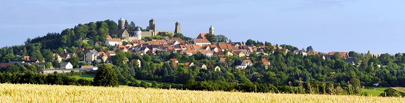
| In 1559 the town, like the castle, was incorporated into the Electorate of Saxony. Its development as an artisans' town was now promoted by the Electors just as it had formerly been by the bishops. Stolpen was a garrison town until 1764. | |
| Easily the most well-known figure connected with Stolpen is the Countess Cosel (1680 - 1765). The former mistress of the Elector of Saxony (Augustus the Strong) was kept prisoner in the Castle, from 1716 to 1765, mostly in the Cosel Tower (Johannis Tower) which was named after her. | |
The city experienced numerous fires in its history. The closely built houses and the town's particularly complicated water supply system (old pump system - "alte Wasserkunst") only encouraged the spread of the flames. With the opening of the Dürrröhrsdorf-Neustadt/Sachsen railway line in 1877, Stolpen was finally made accessible for tourism. In 1950, the district of Altstadt (first mentioned in 1357) was incorporated into Stolpen. |
|
Stolpen Marketplace in 1929 |
Bischofswerdaerstraße in the 19th century |
Aerial Photograph of Stolpen (1926) |
District of LangenwolmsdorfLangenwolmsdorf is a single-street, ribbon development village, the municipality stretching 7 km along the village stream and covering an area of 1991 ha. Today, it contains about 1400 inhabitants. According to the Upper Lusatia Border Document of 1223, Langenwolmsdorf formed part of the northern outer area of the Kingdom of Bohemia. This place was originally called Volueramesdorf (about 1232). In 1559 Wolframstorff was incorporated into the Electorate of Saxony. During the Thirty Years' War, Langenwolmsdorf was attacked and looted by Swedish troops. |
District of HelmsdorfToday, Helmsdorf has about 900 inhabitants and covers an area of 681 ha. The name 'Helmsdorf' can be traced back to a locator named Helwig. It was first mentioned in 1247 under the name Helewigesdorf. In 1559 there was an administrative village and an adjoining settlement. Both were incorporated into the Electorate of Saxony. Two villages developed: Upper Helmsdorf and Lower Helmsdorf. The coalescence into the municipality of Helmsdorf took place only in 1937.During the municipality reform of 1994 Helmsdorf was incorporated into Stolpen. |
District of LauterbachLauterbach lies to the north-east of Stolpen on an area of 901 ha and has about 620 inhabitants. In 1223, this single-street village formed part of the Meißen castle forest of Göda. In 1262, Lauterbach entered into the possession of the bishops of Meißen. In 1559, Lauterbach, along with the episcopal district of Stolpen, belonged to the Elector of Saxony. The Lauterbach Easter Column was erected in 1584. In common with the other surrounding districts, Lauterbach has been part of Stolpen since 1994. |
Rennersdorf-NeudörfelRennersdorf-Neudörfel, with about 600 inhabitants, covers an area of 636 ha to the north-west of Stolpen. The cattle path hill on the village lands of Rennersdorf was expressly named in the Upper Lusatia Border Document of 1222. The district was first mentioned under the name of Reynhartsdorff in 1411. The name Rennersdorff first appears in 1559, when the district became part of the Electorate of Saxony. Since the second half of the 18th century, the main breeding centre for Spanish Merino sheep has been located here.With the incorporation of Neudörfel in 1964, the district of Ort Rennersdorf-Neudörfel was created. |
HeeselichtWith about 420 inhabitants, Heeselicht covers an area of 363 ha. As an original ribbon development village with a single-street area, it extends around a flat valley basin. It was first mentioned as Heselich in 1378. For a long time it belonged to the manor of Krumhermsdorf. The first mention of a manor in Heeselicht comes in 1612. The road from Stolpen to Hohnstein once led through Hohburkersdorf. In order to establish a shorter route to Hohnstein, the Emperor Napoleon rerouted the road through the village of Heeselicht in 1813 ( Napoleonstraße ). |

Burgstadt Stolpen - Sächsische Schweiz